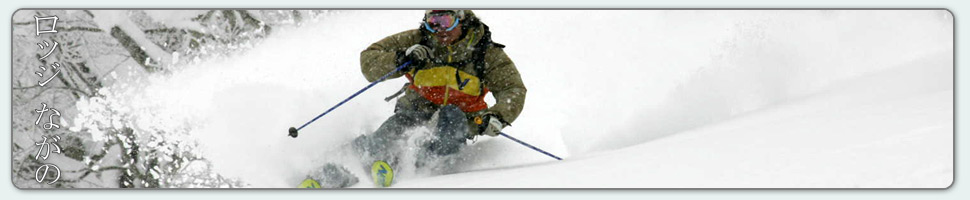
Nozawa Onsen Accommodation, Nagano, The Alps Japan
Nestled in the Japan Alps is a magical place steeped in culture and with some terrific skiing and boarding. Nagano was home to the Winter Olympics in 1998.
Get in touch if keen to get knee deep in powder or neck deep in a Hot Spring soon…
Video
Check out our video of our 4 main properties below.
Nozawa Onsen is a very traditional town with beautiful hot springs, friendly locals, and awesome snow. Our Lodge gives you amazing value and we have a range of accommodation to suit any budget.
The Lodge is only 100m to the slopes and short stroll to town
Relaxed and comfortable atmosphere
In the centre of Japan’s main Island Honshu easy access from anywhere
You can fly direct to Tokyo and there is a shuttle bus direct to the Lodge
English and Japanese Speaking Staff to help with all your needs
Unique and beautiful place with breathtaking nature and culture
Nozawa Village is also famous for its hot springs, there are many nearby
Lots of terrain, with Gondolas, high speed quads, and long runs – very few lift lines
Thanks Mark – we were first invited to Nozawa years ago and have been enjoyed the skiing, the village and your hospitality ever since. Thanks for helping us enjoy it so much,
The arctic temperatures may stop some, but not all.
Base at top: 350 cm
Temp at Top: -12 Degree
Base at Uenotaira station: 260 cm
New snow since close: 30 cm
Weather: Snow
The coldest morning temperatures I can remember are current on the Yamabiko weather station, recording -12c before windchill. For comparisons sake, a normal cold weather temperature for the 8am Yamabiko reading is consistently -7/-8c. Today is much colder than normal with air streaming straight down from the arctic. There are also strong winds up high so when windchill is factored in the apparent temperature will be more like -20/-25c. Therefore if you value your core body temperature maybe add another layer or two today. Thats not to say don’t go riding as the snow conditions are supreme, as good as it gets! 30cm of overnight snow will make for blower Hokkaido snow quality. So dry you may struggle to differentiate the density between the snow and air. But you can’t breath snow so maybe pack a snorkel too and please don’t do anything stupid.
Yesterday was very similar to today, although not quite as cold (yesterdays 8am reading was -10c). But still the snow was fantastic. So dry and deep. The strong winds kept the gondola moving at a snails pace but it was worth the long ride. Crowds were few and fresh tracks were plentiful. Even the sun made an appearance for about an hour around lunchtime, quickly overtaken again by passing snow showers.
According to the forecast we should see snow showers continue at about the current rate for the remainder of today. Snowfalls will become slightly lighter tomorrow with increasing breaks in sunshine. Thursday will be a great day with clear skies, light winds and cold temperatures. Further ahead we are looking at some rapidly undulating temperatures and variable weather. For next weekend until Monday we expect snow, sun and rain in no particular order. It will be cold one day, hot the next and then cold again. Weird. We’ll see what happens…
During the early hours of this morning heavy falls of snow descended on Nozawa Onsen producing no less than 30cm of fresh powder from top to bottom across the resort. There will be some great skiing and boarding in all areas with very cold temperatures and snow showers continuing for the rest of today. Expect foggy conditions up top with improving visibility across the lower stretches of the mountain. Crowd levels will be much reduced in comparison with the last two days.
Yesterday was a fair day of skiing. There were still some fresh tracks to be had thanks to strong overnight winds filling in windblown snow on the upper elevations. Good weather and strong sunshine meant that the best skiing was had in the morning. During the afternoon the snow became heavier under increasing temperatures. Yamabiko however retained good snow throughout. The weekend crowds meant there were big lines in some areas, especially around early to mid morning.
Looking at the forecast ahead we expect snow showers to continue on and off for the rest of today and tomorrow before easing at some point on Wednesday. Cold temperatures will remain until we see the first break of sun but will never climb too high until Friday thanks to a continued NW flow. We expect sunshine all day on Thursday. Further ahead in the long range we continue to see mixed an variable weather from next weekend. Looks like we may experience our first tropical incursion in some time. Overall, the forecast will become much clearer in the coming days.
Snowfalls eased overnight as the wind swung around to the SW and as a result we have no significant increase in coverage since first lifts yesterday. Right now out the window its partly cloudy with occasional breaks of sunshine, its going to be a mostly fine day on the hill. Make sure you bring the camera up with some luck you may capture to Sea of Japan, potentially visible to the West (look back towards the lifts from the top of Yamabiko). The best skiing will be at Yamabiko early with fine quality on and off piste. When this becomes tracked the mid station lifts will be the next port of call for some fun intermediate level powder runs through the trees. This area is great for avoiding the weekend crowds with a double and triple chair running. For more advanced riders the skyline blacks will be worth a look all though be wary of the glide crack that has formed on Grandprix.
Yesterday we saw strong winds ease into the afternoon and as the clouds gradually lifted it revealed some fresh wind lips and other features created by the shifting snow. In the absence of any sun the snow remained in top shape with knee deep powder that fell throughout the day across the resort. From first to last lifts an additional 20cm collected from top to bottom. Foul weather seemed to keep the crowds at bay that would otherwise would have been substantial. Stability at the moment is very low with numerous wind driven slab avalanches across the slopes. Glide cracks are also beginning to open up thanks to last weeks heavy falls. As per usual, do not duck ropes; especially those with inflated egos. You may find yourself in trouble very quickly.
Analysing the forecast we can expect about 3 days of cold Siberian flow from Sunday night until at some point on Wednesday. This should produce consistent falls of excellent quality powder snow perhaps totalling between 20-30cm per day. The heaviest falls look to occur on Sunday night and Tuesday which will be accompanied by moderate NW winds. Thursday looks like it will be clear but remain very cold. On Friday we expect temperatures to warm. Im not too certain on how the weather patterns will fall from Friday onwards. At this stage its looking extremely variable with a soupy mix of high and low pressure.
Thunder, lightning and strong winds accompanied daybreak this morning in Nozawa Onsen. I woke to the sound of snowflakes and soft hail rattling the side of the lodge as the storm broke overhead. Storms are an irregular occurrence in the winter only occurring a few times per season if at all. As of 5am no fresh snow had fallen, but from this time to 8am 10cm had collected on the upper slopes. Although the temperatures aren’t especially cold, the wind chill will make it feel much colder today. At the moment the upper mountain is soaked in fog while the lower mountain is relatively clear. Highest quality snow will be found towards the top, becoming heavier on the lower mountain.
Yesterday remained mostly clear for the duration. Occasional high cloud passed accompanied by gusts of strong wind. The snow was best in the morning remaining light and dry. By around lunchtime the temperatures had warmed which resulted in heavier snow, very sun affected on the Southerly aspects. All in all another good day on the hill.
We should see snow showers ease into the afternoon today with a brief pause until tomorrow night. This will mark the start of another more prolonged run of snowfalls and very cold temperatures. Light to moderate snowfalls should continue to sea level from Sunday night until some point on Wednesday. Thursday is expected to be clear. Next weekend looks to be a mixed bag of variable weather; its uncertain at this stage what exactly will occur, snowfalls or partly cloudy days. Check back tomorrow for further updates.
The unbelievable views of a clear day at Nozawa Onsen.
Base at top: 300 cm
Temp at Top: -8 Degree
Base at Uenotaira station: 230 cm
New snow since close: 0 cm
Weather: Clear, valley fog
Much like two days ago we have some morning fog floating about the valleys. The village is entirely shrouded giving a highly atmospheric feel but at higher elevations its a different story. The top of the mountain is basking in sunshine, all be it with decidedly chilly temperatures of around -8c. While the atmosphere is not quite as clear as Wednesday, there will surely be some photogenic views from Yamabiko and so this area holds my highest recommendations for the day. With no fresh snow overnight it’ll be all about the groomers today. They will be fast and thanks to the light crowds, very smooth. The valley fog will dissipate later.
Yesterday was also quite a step down from Wednesday but still very good. It was extremely quiet on the mountain, i suspect many took a day off to rest. Even though fresh snowfalls from the preceding night weren’t significant, strong overnight winds blew in snow to almost cover most tracked areas. Heavy fog covered the mountain for much of the morning, partially clearing during the afternoon.
Looking ahead at the forecast we should see snowfalls kick off again tonight with moderate falls predicted, increasing into tomorrow morning. It will then partly cloudy on Saturday afternoon or Sunday morning as a small nearby low pressure inflow makes it presence known. From Sunday night or Monday morning the temperatures will become very cold with consistent snow from the NW for Monday, Tuesday and Wednesday. Precipitation rates aren’t as high as last week but we are expecting some very decent accumulations over this time period. Later in the week an out of place high pressure will move over Japan influencing fine conditions.